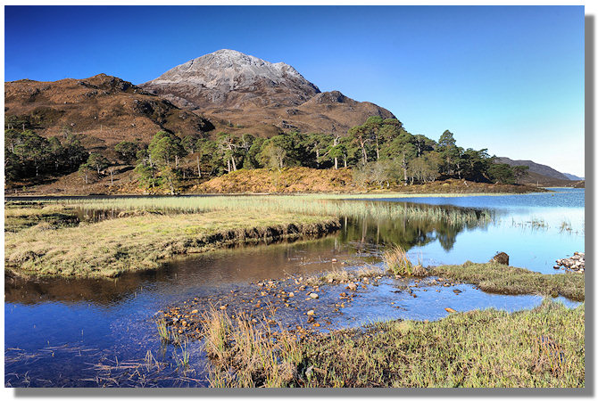
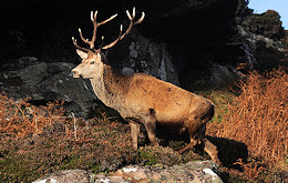
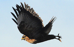
The vast tracts of Scots pine trees which spread and covered more than half the land mass have receded to a few acres on the banks of Upper Loch Torridon, and the wildlife that has survived, or indeed come to flourish in the area is uniquely suited to an environment that keeps most humans away.
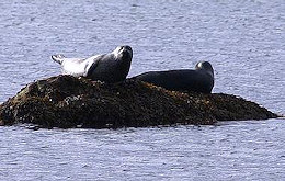
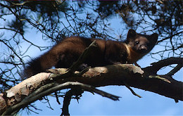
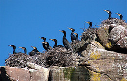
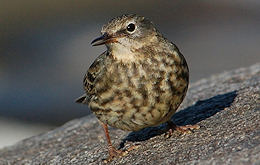
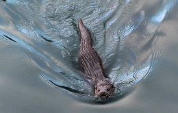
The lochs, forests and hills support a massive range of wildlife.
Visiting Torridon The road through Torridon village, takes you first past a beautifully situated village on the shores of Loch Torridon - Inver Alligin. In the past, illicit whisky distilling and smuggling were commonplace in Alligin. A naturally camouflaged cleft in the rock known as the Smuggler's Cave concealed any illegal activities from the attentions of the excisemen across the loch in Shieldaig. The road continues westward, providing stunning views across Loch Torridon as well as views over the Isle of Skye, eventually grinding to a delightful halt in the charming fishing village of Diabaig, with its scattered hillside crofts, sheltered harbour and salmon farm. The village was used as a filming location for the Hollywood movie 'Loch Ness' - which is worth watching solely for the scenery (Ed.).
~ Looking towards Skye on the road to Diabaig ~ If you visit, be sure to call into the Torridon Countryside Centre, situated at the head of Loch Torridon. It contains lots of useful information on the area, its wildlife, and any local events that are forthcoming (like the boat race round Shieldaig island!) Travelling east up Glen Torridon, (which follows the river A' Ghairbhe some 15 miles from the shores of Loch Torridon to Kinlochewe), one passes both the beautiful Coulin Estate and the Beinn Eighe nature reserve (which is the largest in Britain, covering over 10,000 acres - stretching from loch to mountain top). An excellent track runs south from Glen Torridon, past Loch Clair, Loch Coulin, and eventually into Strathcarron. It is a right of way due to a legal battle in the 1930's. Originally cut for the use of the proprietor of Coulin Lodge to gain access to the railway in Glen Carron, it offers a beautiful walk through empty country, with Carn Breac on one side and Beinn Liath Mhor on the other. As you leave Glen Torridon, take a moment to glance back at the superb view of Beinn Eighe over Loch Clair.
Loch Torridon splits into two sea lochs, Upper Loch Torridon and Loch Shieldaig. On the banks of Loch Shieldaig sits Shieldaig village.
Shieldaig village was actually built to 'raise' and train sailors to fight Napoleon. Grants were given for boats, and £2,700 was spent building the three main streets. Building started in 1810, but then Napoleon was defeated at Waterloo, and the brave men of Shieldaig were never asked to fight.
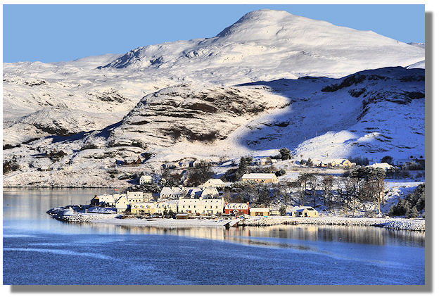
~ Loch Shieldaig & Shieldaig village in winter ~ The church was built in 1825, and the school added at the end of that century. In 1893, the minister of Shieldaig broke away from the established church along with the minister of Raasay to form the Free Presbyterian Church. At one time, the road ended at Shieldaig, and those intent on going north could only do so by boat as foot passengers to Torridon village, Inveralligin, or Diabaig. A track of sorts, suitable for walkers, led eastwards for eight miles along the southern shore of Upper Loch Torridon where a road could be joined again. In those days, Shieldaig to Torridon village by car necessitated a 60 mile detour via Lochcarron, Achnasheen and Kinlochewe. More history on the Historical Perspective page
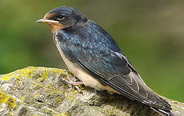
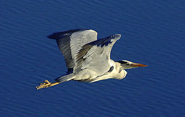
The Shieldaig fishing industry is now limited to prawns and mussels - so the name Shieldaig ('Herring Bay') is rather redundant - although the herring gulls are fatter, but the sea still plays a vital role in the economy of the area and it is still a place where young people learn sea-faring skills. The original houses still exist and have been joined by several more as the village expands. Improved communications have opened up the area to tourism, but the population of the area of a whole is still falling. Shieldaig village now has about 85 full time occupants. Shieldaig Island is covered with Scots pine which are thought to have been planted deliberately about 130 years ago to provide the village with poles for ships and fishing nets. The island is now a National Trust site of special scientific interest and has a thriving bird population, including Herons, Kestrels, Black Guillemots, Long Eared Owls and Mergansers. The road from Shieldaig takes you over the highest mountain passes in Britain, onto the Applecross peninsular - one of the most remote places in Western Europe, which has stunning views over to Raasay, Rona and Skye (and some great beaches).
The place names around Torridon are derived from Gaelic or the Norse occupation:
If you'd like to know more about the geology, natural history and wildlife of the Torridon area, follow the link below and buy Chris Lowe's excellent book (from Amazon) Torridon: the Nature of the Place - Chris Lowe
I hope you've enjoyed this 'not for profit' site Follow Steve on > twitter
please e mail if you wish: Steve at SteveCarter.co.uk - or follow the links below: all photos copyright Steve Carter and may not be used without permission (usually given) |


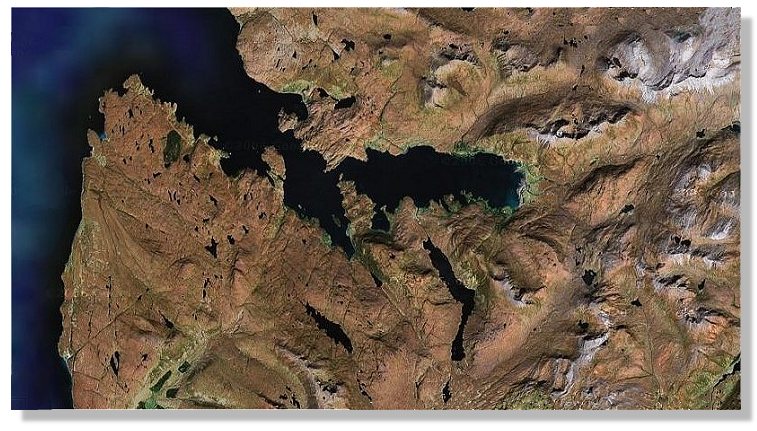 ~ Torridon seen from satellite ~